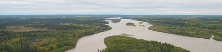


Hydrology of the Athabasca Oil Sands Region
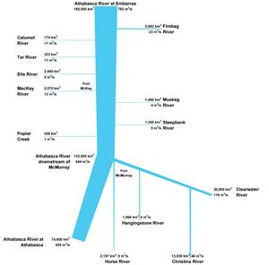
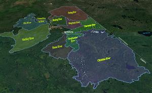
Numerous tributaries flow into the Athabasca River within the Athabasca oil sands region. The streams, rivers, lakes, and wetlands in the region may have different hydrologic characteristics due to differences in topography, climate, vegetation, surficial geology, water storage, and groundwater-surface water interactions.
Industrial development has occurred within many of these basins, while others remain unaltered by oil sands projects or other large-scale activities. Industrial development has the potential to significantly alter the natural hydrology of river and lake systems through water extraction and discharge, changes to the landscape that alter natural drainage patterns, and effects on groundwater-surface water interactions. Hydrologic changes resulting from industrial development can be assessed by comparing current hydrologic conditions to the conditions that would have occurred in the absence of development. Understanding the hydrology of surface water systems in the area is key to minimizing impacts on water supply that ultimately affect aquatic ecosystems and human communities.
In the following sections, the general hydrologic characteristics of several drainage basins within the Athabasca oil sands region are described. Each of the basins listed below is monitored by the Regional Aquatics Monitoring Program to further develop an understanding of the natural variability of and short- and long-term trends in hydrologic variables, as well as potential changes related to oil sands development.
- Athabasca River
- Calumet River
- Christina River
- Clearwater River
- Ells River
- Firebag River
- Hangingstone River
- MacKay River
- Muskeg River
- Steepbank River
- Tar River