


Geologic History
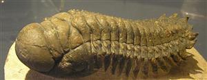
The landscape of northern Alberta and the underlying mineral formations are the result of millions of years of geologic events. The periodic inundation and retreat of ocean waters over present-day Alberta has been one of the most influential processes on Alberta’s geology. At the beginning of the Paleozoic Era (about 600 million years ago), the deposition and decay of the remains of the Trilobites, Earth’s first skeletal animals, led to the formation of immense layers of limestone over the Canadian Shield (Fitzgerald 1978). Ocean waters again flooded present-day Alberta during the late Devonian period (which ended about 360 million years ago), resulting in the expansive growth of coral reefs across the province. These structures acted as sponges to absorb and trap oil created by decayed plant and animal remains. It was during this time that many of Alberta's oil reservoirs were created.
During the Mesozoic (“middle life”) Era, from 225 to 70 million years ago, Alberta alternatively emerged from the ocean depths, and was submerged again (Fitzgerald 1978). Deep bands of marine sediments were laid during the floods, and were shifted and spread by winds and rivers during continental uplifts. During the late Jurassic period, about 150 million years ago, the Black Hills of South Dakota rose to form an immense freshwater swamp where large dinosaurs flourished. Slowly, this uplift of land spread to Alberta, creating vast deltas and swamps from what had been shallow ocean floors. The transition to land was complete by 120 million years ago, and marked the final time that the Pacific Ocean would cover the lands of Alberta. Today these areas, which include the Crowsnest Pass and Bow Valley, contain rich coal deposits.
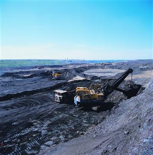
During the late Jurassic to mid-Cretaceous periods, a mountain range emerged on the west coast of British Columbia. As the Coast Mountains rose, Alberta and the Mackenzie River Valley sank, allowing the Arctic Ocean to migrate south until it crossed into northern Alberta. The resulting embayment caused north-flowing rivers to deposit their sediments, which were then washed clean by the tides. These sands are now known as the McMurray Formation. The McMurray Formation contains the Athabasca oil sands bitumen deposit, which covers some 46,800 square kilometers at an average thickness of 38 metres.
About 85 million years ago, global sea levels rose significantly, completing an oceanic connection between the Gulf of Mexico and the Arctic Ocean that stretched from central British Columbia to eastern Manitoba and present-day Lake Superior. During this time, thick layers of fine clays were deposited. These clay layers now act as impervious caps that seal oil deposits in sand, salt and coral formations found below the surface of the Fort McMurray area.
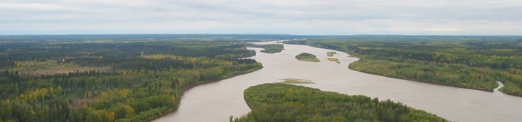
During the Quaternary Period (2 million years ago to the present), ice advanced and retreated in about 80 glacial cycles. The most recent ice advance was the Wisconsin glaciation of 70,000 to 10,000 years ago. During this period ice sheets extended south to 45° N latitude, and were between three and four kilometres thick. The Laurentide ice sheet covered about 80% of the Mackenzie River basin, extending from the eastern edge to the Rocky Mountain foothills to merge with Cordillera glaciers that extended over the mountain valleys (Culp et al. 2005). Several icefields still remain from the last glaciation, including the Columbia Icefield at the headwaters of the Athabasca River. Meltwaters from the Laurentide and Cordillera ice sheets created many of the rivers and lakes present in the Athabasca River basin today.