The Mackenzie River Basin
At 138,000 km², the Athabasca River basin accounts for approximately 5% of the immense Mackenzie River basin, the largest northward flowing river basin in North America and the primary North American source of freshwater to the Arctic Ocean. The Mackenzie River system extends over 4,241 km from its most distant source to its delta on the Beaufort Sea. The river drains an area of 1.8 million km², a fifth of Canada’s land, and has an average annual discharge of 9,910 m3/s.
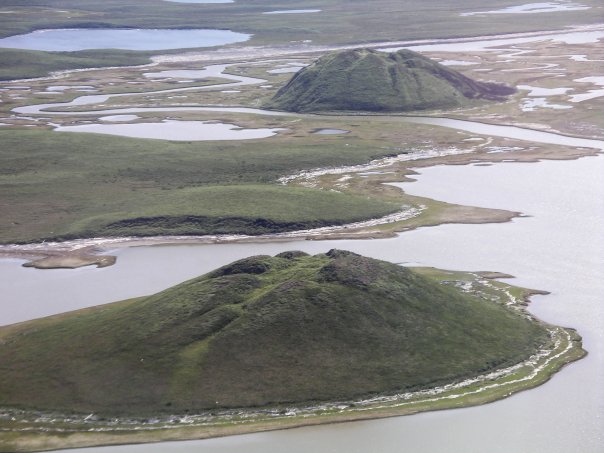
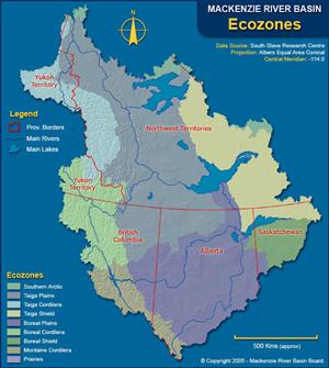
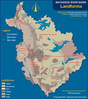
The Mackenzie River basin is the 10th largest river basin in the world (MRBB 2004), extending over 20° of longitude and 15° of latitude from the Rocky Mountains to the Arctic lowlands. The basin includes numerous different ecozones and landforms (MRBB 2001; see the images on the right). Permafrost underlies 75% of the basin. A unique feature of the Mackenzie River basin includes the conical, ice-cored hills, called pingos, located in the Beaufort coastlands (NRCAN 2008a).
The Mackenzie River system played an important role in the fur trade, and is still an important transportation route for northern communities. While the northern part of the basin is still sparsely populated, demand for its resources—including minerals and fossil energy—is increasing (MRBB 2003).

Pingos near Tuktoyaktuk, Northwest Territories. Source: Emma Pike


