Overview of Athabasca River basin landscape
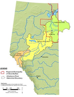
The headwaters of the Athabasca River arise from the melting snow and ice of the Athabasca Glacier, one of six major glaciers extending from the Columbia Icefield in the Rocky Mountains near Jasper, Alberta (NRBS 2002). The river flows northeast across Alberta for over 1,300 km before flowing through the Peace-Athabasca Delta into Lake Athabasca. From Lake Athabasca, water flows northward via the Slave River to Great Slave Lake, the Mackenzie River, and the Arctic Ocean. The Athabasca River is the longest river entirely within Alberta, and is the longest undammed river in the Canadian prairies. The Athabasca River basin covers an area of approximately 138,000 km2, and includes landscapes as varied as snow-capped mountains, agricultural plains, boreal forest, wetlands, and small urban centres.


