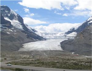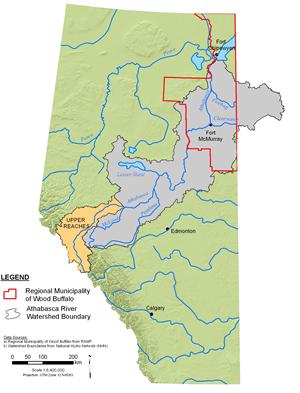


The Athabasca River: Upper Reaches
The upper reaches of the Athabasca River flow through the rugged, mountainous topography found within Jasper National Park, and are located within the alpine, sub-alpine, and montane ecoregions (areas that are broadly similar in terms of geography, climate, topography, and vegetation). The alpine ecoregions are dominated by heath, while sub-alpine ecoregions are dominated by lodgepole pine and Engelmann spruce. At lower elevations, the montane ecoregions support open forests dominated by Douglas fir, lodgepole pine, white spruce, and aspen (Prepas and Mitchell 1990, NRBS 2002).
The upper reaches of the Athabasca River have played an important role in the history of this region. The river valley was a major fur trade route, and was also significant in the surveying and mapping of western Canada. Because of this historical significance, natural beauty, and the recreational opportunities offered by the river, the portion of the Athabasca River located within Jasper National Park has been designated a Canadian Heritage River. Nonetheless, the natural ecology of the river has recently been impacted by development, including transportation infrastructure such as culverts that hinder fish access and pollution from Jasper’s sewage treatment facilities (CHRS 2008).