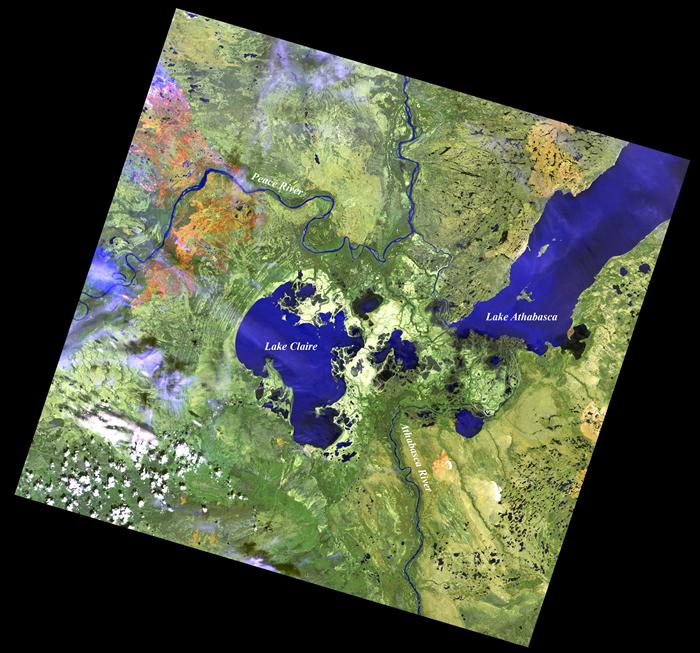
A satellite image of the Peace-Athabasca Delta and Lake Athabasca from 2007. The Athabasca River is visible at the bottom of the image, while the Peace and Slave rivers are visible at the top of the image.
Source: Landsat-5 TM image from the U.S. Geological Survey (USGS)